Laser maping
Being completely different from those traditional satellite images or aerial photos, airborne laser swath mapping (ALSM) creates three-dimensional models of the terrain below. How does it work? A small plane, equipped with an optical scanner, emits rapid-fire laser pulses (50,000 to 150,000 per second) that are reflected straight down in a zigzag configuration by a moving mirror
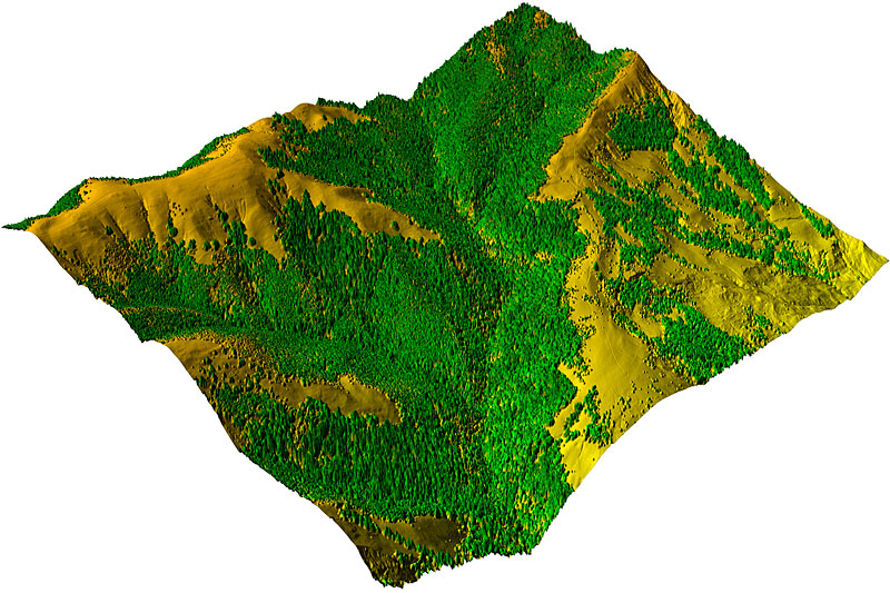
Based on the same principle as radar, a specialized detector in the plane picks up rays as they're reflected off of the ground. By clocking the beams' round-trips, the ALSM can calculate the distance to a single point on the ground. The plane's elevation and motion are controlled for by an onboard inertial measurement unit, and global positioning system (GPS) tracking—along with a ground base station—ensure that the precise location of the airplane is recorded at all times. The result: a rich and rapid model of a mountain.
TO THE Main page
Being completely different from those traditional satellite images or aerial photos, airborne laser swath mapping (ALSM) creates three-dimensional models of the terrain below. How does it work? A small plane, equipped with an optical scanner, emits rapid-fire laser pulses (50,000 to 150,000 per second) that are reflected straight down in a zigzag configuration by a moving mirror
Based on the same principle as radar, a specialized detector in the plane picks up rays as they're reflected off of the ground. By clocking the beams' round-trips, the ALSM can calculate the distance to a single point on the ground. The plane's elevation and motion are controlled for by an onboard inertial measurement unit, and global positioning system (GPS) tracking—along with a ground base station—ensure that the precise location of the airplane is recorded at all times. The result: a rich and rapid model of a mountain.
TO THE Main page